Research Overview
Advancing Cloud and Precipitation Parameterizations in Numerical Climate Models
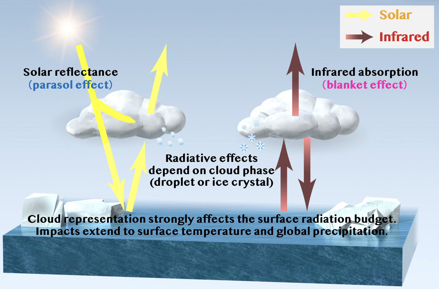
Improving the representation of aerosol–cloud–precipitation interactions—one of the greatest sources of uncertainty in climate modeling—is essential for enhancing the reliability of future climate projections. Aerosols interact with clouds and precipitation in highly complex ways, and current global climate models (GCMs) exhibit significant inter-model spread in quantifying these effects.
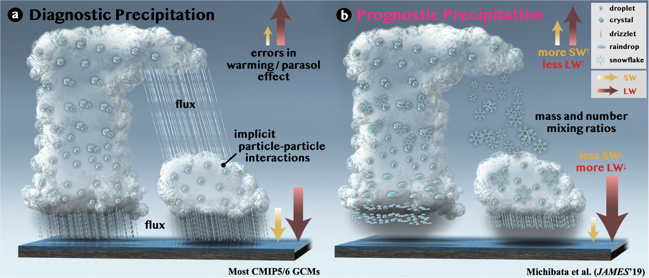
One major reason for this uncertainty lies in the overly simplified treatment of precipitation. Most GCMs adopt diagnostic precipitation schemes to reduce computational cost (Figure 1a), which assume that hydrometeors instantly fall to the surface. This approach lacks the capacity to simulate precipitation formation based on the growth history of clouds. To address this, we have developed a prognostic precipitation scheme called CHIMERRA (Cloud/Hydrometeors Interactive Module with Explicit Rain and Radiation; Figure 1b), which explicitly simulates the time evolution of rain and snow processes (Michibata et al., 2019, 2020). This enables more realistic representations of cloud, precipitation, and radiative processes.
By advancing these cloud and precipitation modeling techniques, our goal is to achieve more accurate simulations of the global water cycle and Earth’s energy balance, ultimately contributing to more reliable climate projections.
Understanding Precipitation Processes Using Satellite Observation Data and Simulators
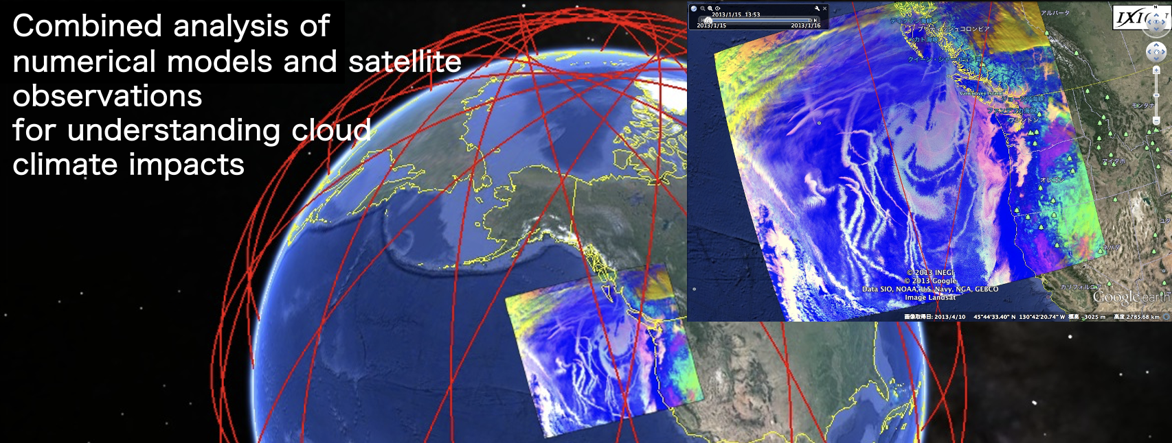
To improve the performance of climate models, it is crucial to conduct comparisons and validations using satellite observation data effectively. To accelerate evidence-based climate model development, we are also advancing the development of tools to diagnose numerical model performance.
There are various satellite sensors that observe aerosols, clouds, and precipitation, such as MODIS, ISCCP, MISR, CloudSat, and CALIPSO. However, since each sensor has different detection sensitivities and algorithms, several technical challenges exist in comparing numerical models with satellite data in a consistent manner. Satellite simulators are software tools that reproduce these multiple satellite observations on a virtual Earth created by a computer. These simulators play a crucial role in providing a "common language" for clouds, essential for a consistent comparison between numerical models and satellite observations.
Our research group is internationally contributing as part of the development and operation committee of satellite simulators, and our research is characterized by analyses combining numerical models and satellite observation data (Figure 2).
Understanding of Atmosphere-Ocean-Cryosphere Interactions
The response of clouds and precipitation to climate change is highly complex, and there are still unknown climate feedbacks that may be at play. To comprehensively understand the mechanisms of global warming, it is essential not only to account for the interactions between the atmosphere and oceans but also to deepen our understanding of the climate change mechanisms in polar regions, where warming signals are particularly pronounced (Figure 3).
Using the latest climate models with significantly reduced uncertainties, we are advancing research to unravel multi-domain climate feedbacks spanning the atmosphere, ocean, cryosphere, and human systems—areas that traditional simplified climate models struggled to address due to challenges in accurately reproducing cloud and precipitation processes. Moreover, by conducting multi-model analyses using simulation results from various climate models developed worldwide, we aim to identify the factors contributing to the uncertainties in climate predictions at the mechanistic level.